사진작가, 드론을 띄워 아이슬란드의 독특한 지열 풍경을 포착하다

0 0 4 2025-07-07

Aerial view of a geothermal area with colorful earth tones, showing a winding white path connecting bubbling pools of water, surrounded by green patches of vegetation.


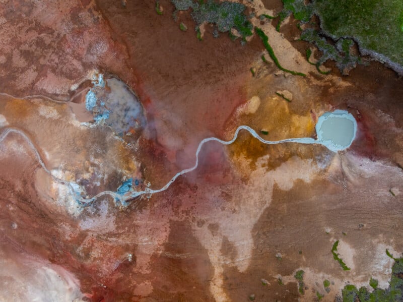
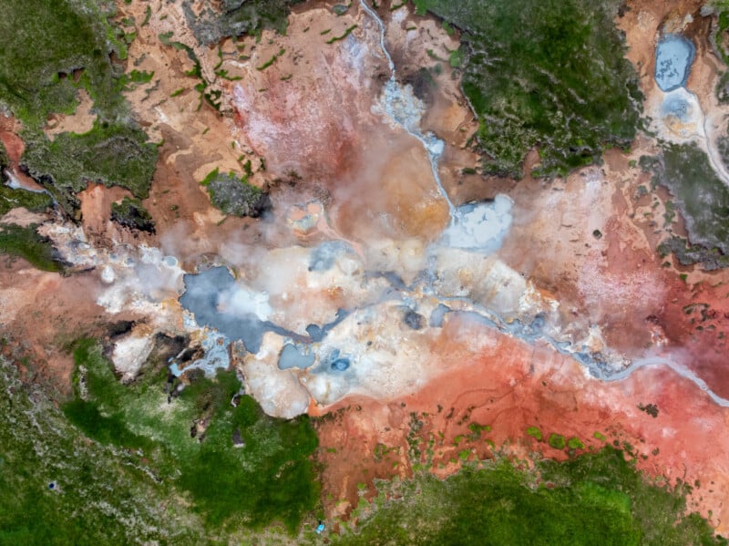
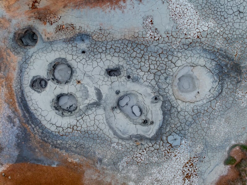
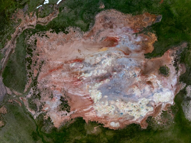
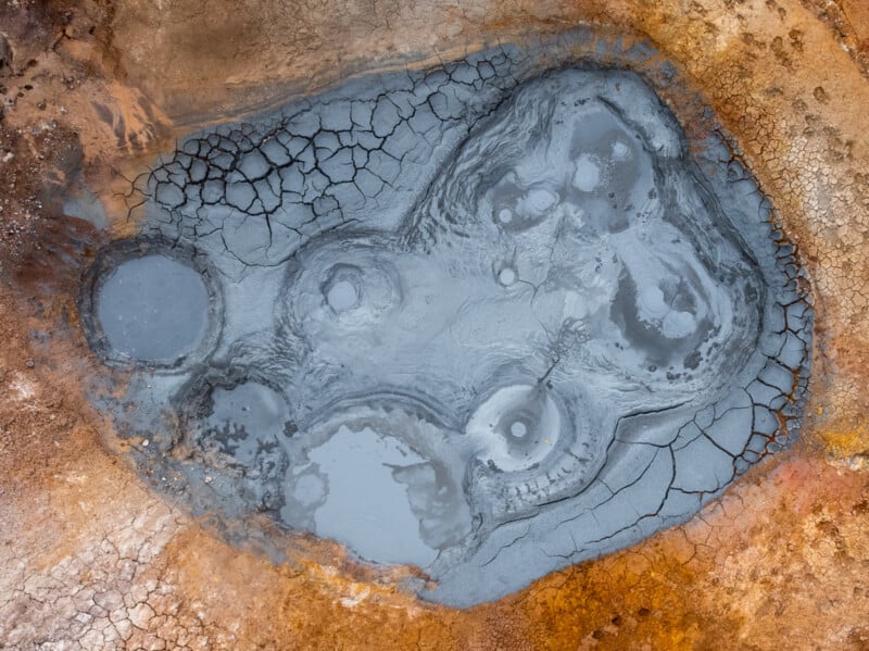
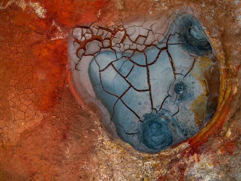
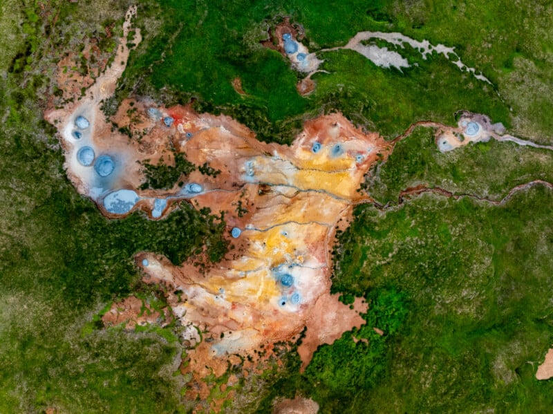
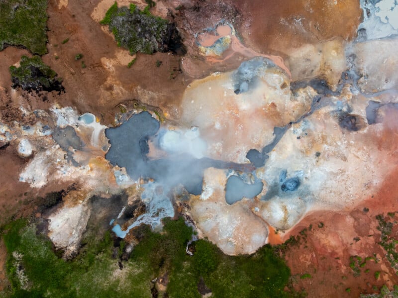
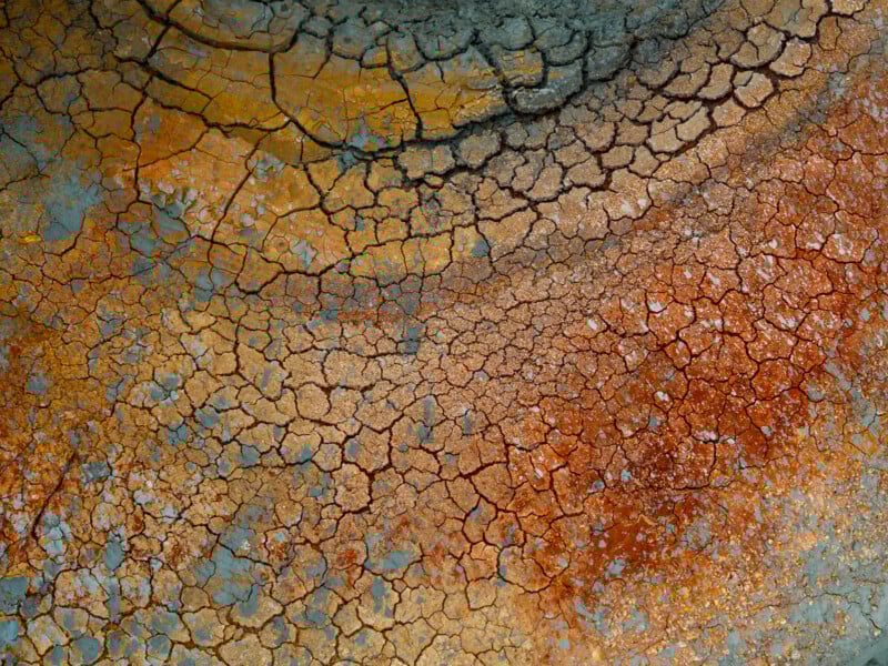
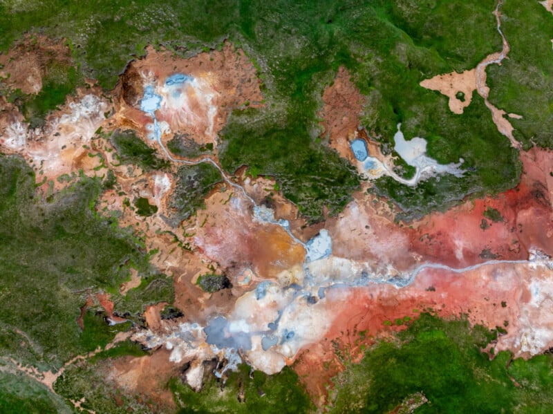
한 사진작가가 드론을 이용해 지열 온천 위를 비행하며 다채롭고 질감 있는 온천의 추상적인 이미지를 포착하고 있다.


빌헬름 군나르손은 아이슬란드 출신의 보도 사진작가로, 이 나라는 대서양 중앙 해령과 화산 지대에 위치해 있어 풍부한 자연 온천으로 유명하다.


강렬한 지열 활동은 지하수를 가열하여 지표로 상승하게 하며, 이는 자연 온천을 형성하고 국가에 지속 가능한 에너지원으로 제공한다.


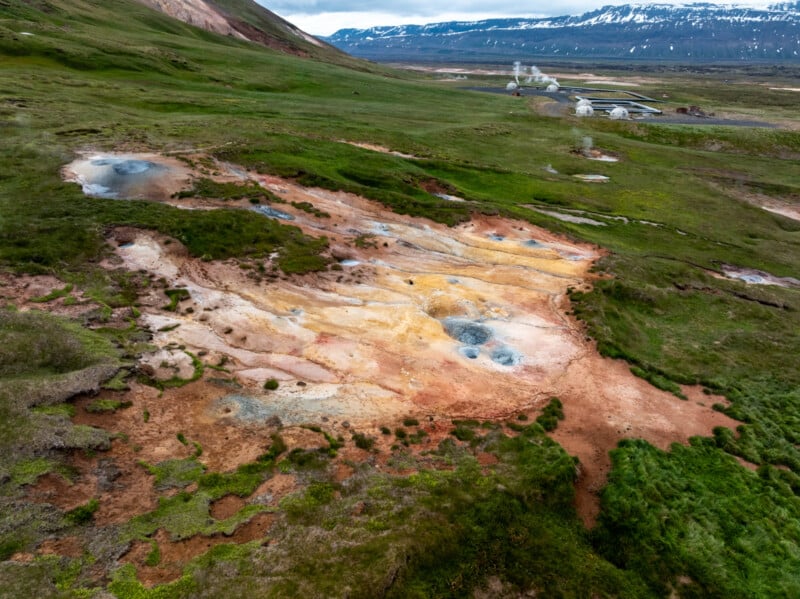
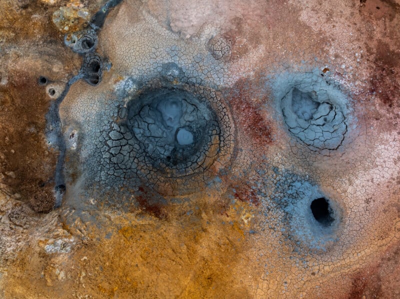
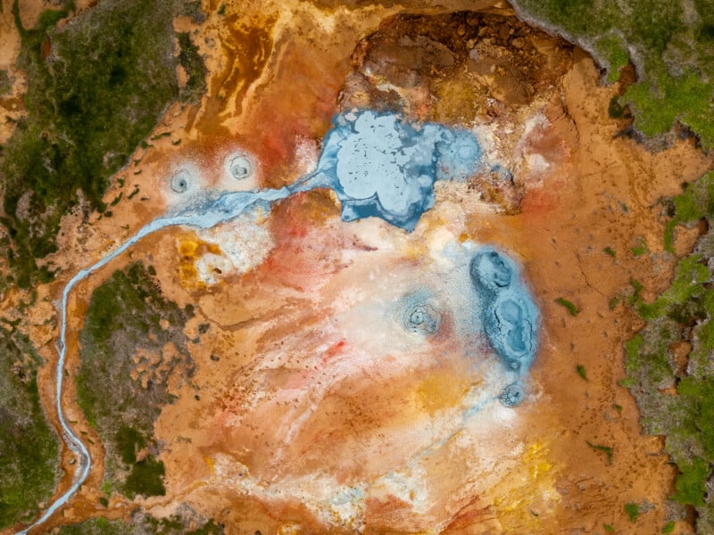
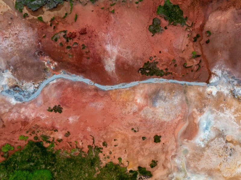
군나르손은 아이슬란드의 Þeistareykir라는 지역의 특히 다채로운 지열 지대를 방문했다. 그는 이곳이 다소 외진 곳에 있지만 방문할 가치가 충분하다고 말한다.


“Þeistareykir에서는 다양한 종류의 온천과 진흙 웅덩이, 푸마롤, 그리고 생생한 지열 색상을 볼 수 있습니다. 이곳의 땅은 흰색과 노란색, 주황색과 밝은 빨간색, 갈색과 회색으로 이루어져 있으며, 어디를 보든지 땅에서 연기와 배출물이 올라옵니다,”라고 그는 말한다.


Aerial view of a geothermal area with vibrant mineral deposits in red, orange, and white, steaming hot springs, and patches of green vegetation surrounding the colorful landscape.


A person stands near colorful geothermal hot springs with steaming vents, mineral-stained ground, and warm pools surrounded by green grass.


Aerial view of cracked, dry earth with several circular mud pools and patches of white and reddish soil, resembling a geothermal or volcanic landscape.


Aerial view of a large, multicolored geothermal area with patches of green vegetation on the edges and varying shades of brown, red, white, yellow, and gray across the surface, creating a textured abstract pattern.


Aerial view of a bubbling mud pool with cracked, dry edges and patches of smooth, grey mud in a geothermal area surrounded by orange and brown earth.


Aerial view of a cracked, dry mud pool surrounded by vibrant red, orange, and beige earth, creating an abstract, textured landscape with natural patterns and color contrasts.


Aerial view of a geothermal area with steaming vents, multicolored earth, patches of green grass, and distant mountains partially covered with snow.


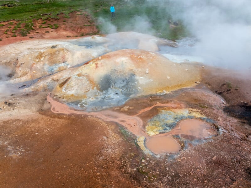
군나르손은 DJI Mavic 3 Pro 드론으로 촬영했으며, 이는 화산 폭발을 촬영할 때 피사체에 너무 가까이 가지 않고도 수직으로 촬영할 수 있어 훨씬 쉽게 이미지를 포착할 수 있다고 말한다.


“드론은 또한 안전성을 높여줍니다. 일부 온천은 지열수로 인해 80-100°C (176-212°F)까지 뜨거워질 수 있으며, 지하에서는 240ºC (464°F)까지 뜨거워질 수 있습니다,”라고 군나르손은 설명한다. “이곳들은 절대 만지면 안 됩니다! 또한, 사람들이 너무 가까이 가면 진흙에 발자국이 남습니다.”


Aerial view of a geothermal area with cracked blue-gray mud pools, surrounded by reddish-brown and yellow earth, showing textured patterns and mineral deposits.


Aerial view of a colorful geothermal area with orange, yellow, and brown mineral deposits, scattered blue hot springs, and green grass surrounding the unique landscape formation.


Aerial view of a geothermal hot spring with vivid orange, yellow, and green mineral deposits, blue steaming pools, and surrounding patches of green vegetation.


Aerial view of a colorful, textured landscape featuring red, orange, and brown earth with patches of green vegetation and a narrow, winding gray stream running through the center.


Aerial view of a colorful geothermal hot spring area with steaming pools, mineral deposits in white, orange, and blue hues, and patches of green vegetation at the edges.


Cracked, dry earth in shades of brown, orange, yellow, and gray, forming an abstract, textured pattern that resembles a parched landscape or dried paint.


Aerial view of a geothermal landscape with vivid green grass, rust-red soil, white mineral deposits, and small blue pools connected by winding streams. The terrain displays striking natural colors and abstract patterns.


군나르손은 이러한 장소에서 드론을 사용하는 데 특별한 허가가 필요하지 않았다고 말한다. 그러나 아이슬란드에는 허가가 필요한 자연 보호 구역이 있다.


“아이슬란드에는 드론에 대한 규칙이 있으며, 드론이 머리 위로 날아다니지 않기를 원하는 다른 사람들을 배려하는 것도 중요합니다,”라고 그는 덧붙인다. “그곳에는 나 혼자 있었기 때문에 충분히 비행할 시간이 있었습니다.”


군나르손은 이전에 블루 라군의 일부를 삼키는 화산 용암을 보여주는 극적인 사진으로 PetaPixel에 등장한 바 있다. 또한, 그는 처음으로 화산 폭발을 본 관광객들의 반응을 포착했다.


군나르손의 더 많은 작품은 그의 웹사이트인스타그램에서 볼 수 있다.


이미지 출처: 빌헬름 군나르손의 사진


출처: https://petapixel.com/2025/07/06/photographer-sends-up-his-drone-to-capture-icelands-unique-geothermal-landscape/

소식줍는다람쥐님

프로필